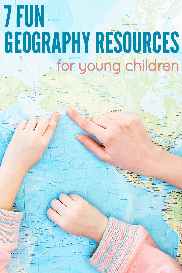
7 Fun Geography Resources for Teaching Children About the World
I remember when our eldest daughter was seven and captivated by learning all about the seven continents as part of the second grade geography syllabus. Learning about all of the countries of the world is fascinating for many children, with maps casting a somewhat magical spell, almost like the key to the kingdom that unlocks the wonders of the whole world!
In fact, I often shares the story of the favourite book on my four year old kindy class’ bookshelf being a street directory for our state. The children loved looking at all of the marks and symbols and using the maps to extend their imaginative play.
The following collection of fun geography resources is perfect for bringing the world to life with children, both at school and home.
1. Create Your Own World Map Placemat
Having the world at their fingertips is a surefire way to invite lots of interesting discussion amongst children. This makes a great placemat for mealtimes at home, or used as a desk mat at school.
Children can colour the free printable map (instructions for printing included below), with older children labelling both the continents and oceans. Glue the completed map onto some lightweight card and laminate for durability.
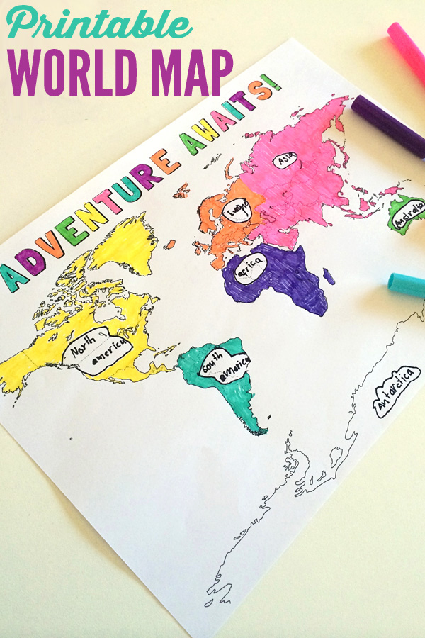
Once their placemat is prepared, you can have fun talking about the continents and countries of the world.
You might invite children to find the places they have personally visited, or those that are home to family and friends living interstate or overseas.
They might also locate the countries favourite story book characters call home – like Madeline in France and Handa in Kenya.
If your placemat is laminated, your child can also circle countries or draw lines representing travel routes between countries using a whiteboard marker – which is actually a really fun way to plan a dream holiday!
2. Hang a Wall Map
If you have the space in your home or classroom, consider hanging a large world map. You might like an easily movable paper world map or could consider a removable wall sticker or more permanent wallpaper option.
Here are four fun options available from Etsy;
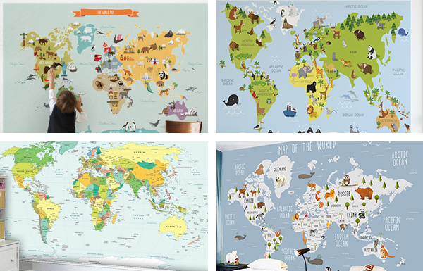
Peel & Stick Fabric Wall Sticker World Map | Educational Map of the World Removable Wall Decal
World Map Wallpaper or Vinyl | Kids Animal World Map Removable Wall Decal
3. Add a Child Friendly Atlas to Your Bookshelf
The Usborne Lift-The-Flap World Atlas is a great atlas for younger children to explore. It includes lots of interesting facts about the countries of the world hiding under a series of durable flaps to lift.
Alternatively, a student’s atlas or beginner’s version – like this National Geographic Kid’s Beginner World Atlas or the DK First Atlas are great for exploring with kids.
You might also like out to check out the list of books about mapping in our Kids Map Activities post or enjoy picture books from around the world on our list, Around the World in 40 Books.
4. Sing The 7 Continents Song
Our daughter learnt the name of the continents after listening to this song at school just a few times.
It’s just one useful resource from our handy collection of 11 Geography Videos for Kids.
5. Invest In a World Map Jigsaw Puzzle
Working together on a world map puzzle provides a fabulous opportunity for children to talk about the world, and many children’s map puzzles include plenty of visual features to talk about – like animals and landmarks native to each country or region. Look for a puzzle with the appropriate number of pieces for your child’s development and interest.
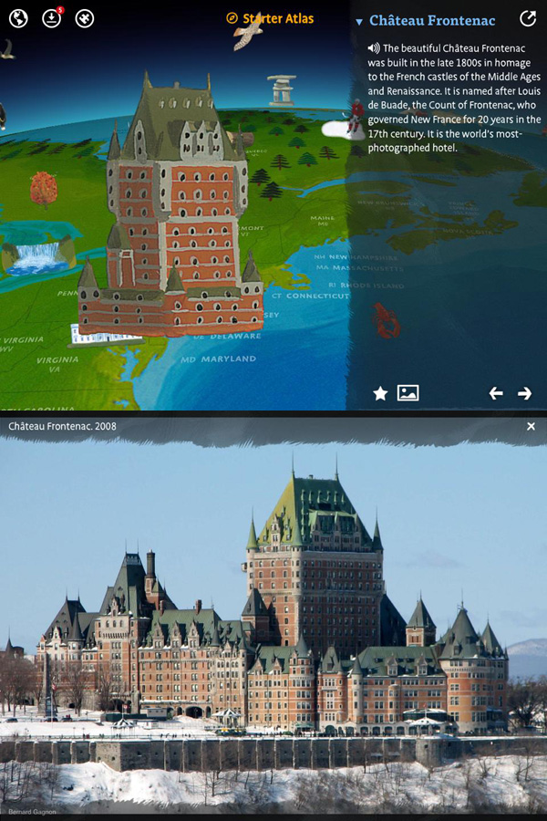
6. Explore the Barefoot Books World Atlas App
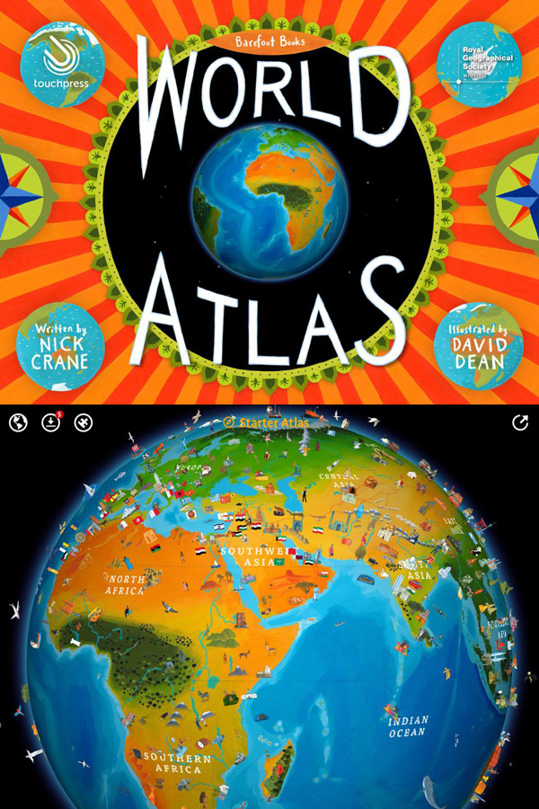
This is a paid app with different modules that can be purchased in-app. We use the cheapest Starter Atlas Pack, and it includes plenty to explore.
The virtual globe spins and zooms, and you can tap on any icon or country to bring up information about the place you have chosen. Younger children can have the information read to them. You can also tap to see a photograph of a range of places, natural features, man made landmarks, animals or machines.
The app includes lot of fun facts to explore!
For older children, you might also like to check out our collection of online geography games for kids.
7. Add a Set of Safari’s Around the World Landmarks Toob
The Safari’s Toob Landmarks Set is a great, hands-on way to match countries with famous landmarks.
The small replicas can be placed on your world map placemat, or added to block play or a small world set up for additional exploration and fun.
How to Print Your World Map for Kids

Click here to download:
Printable World Map for Kids
. Save the PDF to your computer. Open the PDF and print the pages you require. When printing, select “Fit to printable area” (or similar) to ensure the page fits with your printer type and local paper size.
Having trouble accessing or downloading the file? Please try a different internet browser.
Please note: All Childhood 101 printables are for personal use only, you may not use any part of this content for commercial purposes-that includes selling the document, giving it away to promote your business or website, or printing the file to sell. You may not share, loan or redistribute these documents. Teachers may use multiple copies for students in their own classroom.
What wonderful ideas! Thanks!
Hi Christie Burnett,
Thank you for your site here, and your views on children learning through play. I am working on writing/illustrating a non-fiction picture book on the 4 species of edible chestnuts for the 8-12 age group and would like your take on what might be appropriate games or maps that might be workable here. I like your regular maps and the different ways of showing the sites. My story will be of beginning ‘over-puffed’ proud characters, culminating in collapse, and finally realising a need for each other. Diversity and cooperation is fully needed here. Thank you for your helpful response ahead of time.